We have been very lucky this Hurricane season and keep your fingers crossed that this pattern holds. There is a storm just beginning to cross the Atlantic that looks like it could form into a tropical system.
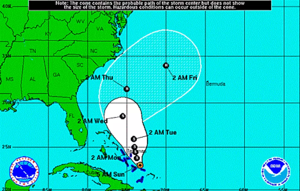
It would seem that (once again) Southwest Louisiana has dodged the tropical bullet. This must come as a shock to those irresponsible web weather prognosticators that earlier this week were predicting a Labor Day weekend hurricane here.
Earlier this week I saw several facebook post warning the Gulf coast about a hurricane next weekend...
Well here we are only six days into the 2014 Hurricane season and we could be looking at our first storm. Wasn't this supposed to be a year when El Nino affected our weather and hindered hurricanes?
We have been watching this area of low pressure for a few days as it moved through the Caribbean Sea. NOAA is now predicting it will enter the Gulf of Mexico later this week.
This is the most tropical activity we have seen so far this year. To this point mother nature has spared us ... unless you have vacationed in Cancun at the wrong time this year.