Meteorologist Zack Fradella: Severe Weather Heading For SWLA
Meteorologist Zack Fradella has the latest report on the severe weather heading for the Lake Area.
Please take heed of Zack's warnings and prepare for the worst. If nothing happens, great, but if the "you know what" hits the fan you will be prepared.
Below are weather reports from his Facebook page:
Today @ 9am:
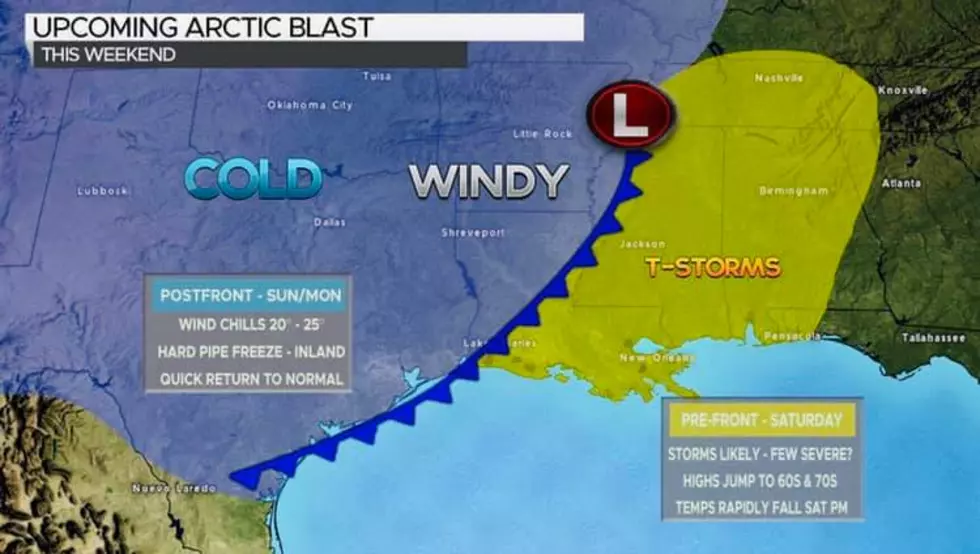
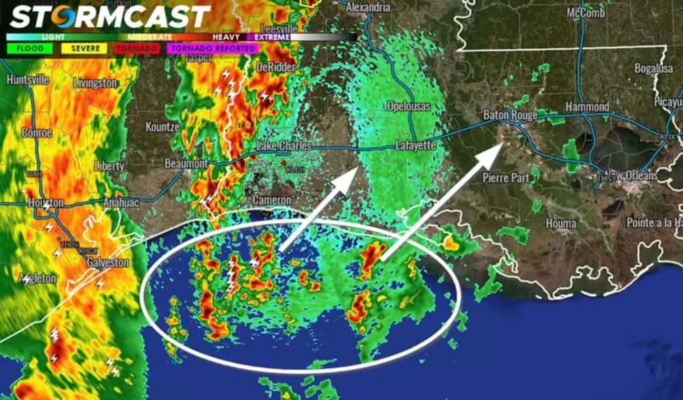
Severe threat starting to increase across South LA. New cells forming offshore will have the potential to become tornadic as they move inland and strengthen.
2 Hours Ago:
A relatively weak mass of storms is slowly marching east into Louisiana this morning and losing steam. As we get some daytime heating going, expect storms to reenergize somewhere over SW LA and offshore leading to a much different radar picture by about the noon hour today. A Tornado Watch is likely to come out by late morning for portions of Louisiana.

Yesterday:
SEVERE WEATHER TIMING...the generic answer is this, most of the daylight hours on Thursday you will need to be on alert. You can see more specific windows depending on what part of the state you live in below.
A couple notes, as meteorologists we do not make the call to cancel school but I will say this, an early dismissal with this kind of timing is not a smart move. Make sure you have multiple ways of being alerted on Thursday and understand the threat has the potential to produce large tornadoes or significant damaging winds so take each warning seriously.

Yesterday:
Significant severe weather anticipated on Thursday across Louisiana. A hatched enhanced risk is indicative of the potential for multiple tornadoes and intense wind damage, especially over the central/eastern half of the state. This event is different from last weekend, we were primed for severe weather last weekend but hi-res models did pick up on most of the storms staying north. Hi-res models for Thursday show numerous storms with a distinct squall-line organizing as it crosses the state, mainly during the day into the early evening hours. All residents are urged to have a severe weather plan in place in case a warning is issued for your location.

For accurate and up-to-date Louisiana and Gulf weather reports, bookmark Zach's website Storm Cast Live.
More From 92.9 The Lake