
Maps Show What Florence’s Impact Would Look Like Around the World
We took this image of Hurricane Florence from the National Oceanic and Atmospheric Administration, then placed it over various places around the world using a Google map set to the same scale.
It's not the most scientific study in the world, but it should give you a fairly accurate idea of just how large this storm is.

Starting off here at home, Florence would cover Texas from El Paso to Orange.

The same goes for most of California...

...and New England.
Now, let's take a peek at what Hurricane Florence would look like across the globe.
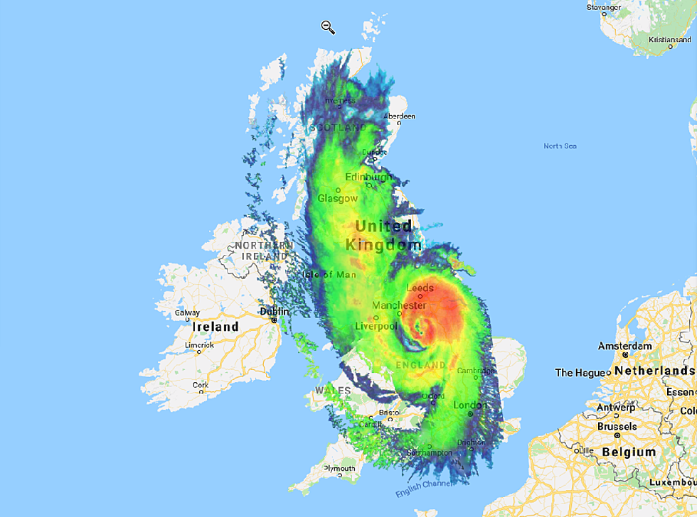
Florence would stretch across the United Kingdom and would swallow Ireland entirely.

Most of Italy would be affected, as well.

As would Japan...

...and Egypt...

...and Iraq...

...and Romania, Serbia, and Bulgaria.
We could keep going, but you get the idea.
The damage from Hurricane Florence will likely be catastrophic, but you can help. Here's how.
More From 92.9 The Lake