Development in the Atlantic — Rare Sub-Tropical Storm
Remember the days when we started getting ready for hurricane season by going out and getting a hurricane tracking chart then waiting for sometime around June to start tracking the storms? Well, people don't really use those tracking charts anymore, but if we did, we'd have something to track right now.
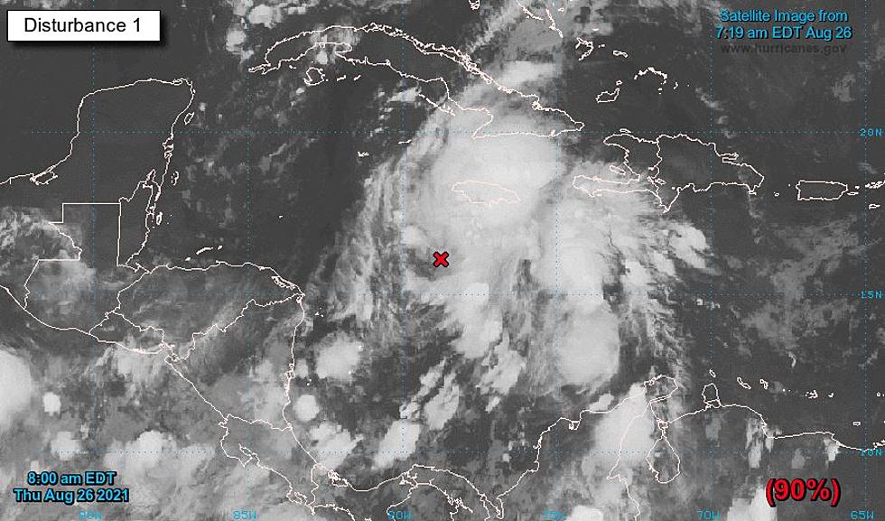
It seems that an area of low pressure has developed in the north-central Atlantic and that system has the potential to become the first named storm of the 2017 Hurricane Season. The storm, if it develops the way the experts think it might, will be named, Arlene.
Now, I don't speak weather man any better than most people, but the experts say that, this system is "sub-tropical" rather than "tropical", I have no idea what that really means, but the bottom line is that the support behind this system is being driven by the jet stream and upper level influence. The experts say that the jet stream and upper level flows don't factor into a true tropical storm.
Meteorologist also point out that, the water temps in the Atlantic are not yet warm enough to allow any real tropical development making this system a rare 'Hybrid" storm. The National Hurricane Center has already labeled the area of low pressure as Invest 91-L, The actual hurricane season doesn't begin until June.
More From 92.9 The Lake
![Texas Tornado Takes Down Wind Turbines [PHOTO]](http://townsquare.media/site/34/files/2022/03/attachment-Screen-Shot-2022-03-25-at-7.01.35-AM.jpg?w=980&q=75)

![Weather Channel Interviews Grand Isle Chief of Police [VIDEO]](http://townsquare.media/site/34/files/2021/08/attachment-Screen-Shot-2021-08-29-at-12.23.53-PM.jpg?w=980&q=75)
![Empty Gallon of Milk Could Come In Handy If Electricity Goes Out [PHOTO]](http://townsquare.media/site/34/files/2021/08/attachment-GettyImages-1257995328.jpg?w=980&q=75)
![Meteorologist Suggests Where to Evacuate To Prior to Hurricane [PHOTO]](http://townsquare.media/site/34/files/2021/08/attachment-GettyImages-1031463982.jpg?w=980&q=75)