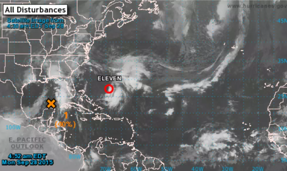
New Distrubance Being Watched in the Gulf
Even as we were rolling into a picture perfect weekend, forecasters were predicting the development of the new system we're watching in the Gulf of Mexico. The system developed over the southern Gulf along the tail end of the frontal boundary that brought Southwest Louisiana absolutely beautiful weather over the weekend.
Right now, the system is just called Invest 94L by the National Hurricane Center and chances for further development are not too good as things stand right now. As with all the Atlantic storms we've seen so far this eyar, the fact that it's already near a land mass and those upper level wind shears will do a number on any system trying to develop in the Gulf waters.
While we may not see a full fledged storm out of this system,the disturbance will push extra moisture toward Southwest Louisiana which will increase our rain chances on Tuesday.
There are also a few areas in the open Atlantic that forecasters are watching and one disturbance located halfway between Africa and the Caribbean has a high chance to become our next named storm. The next name on the list is Ida. If this does develop, it will likely take a track out to sea into the central Atlantic.
More From 92.9 The Lake