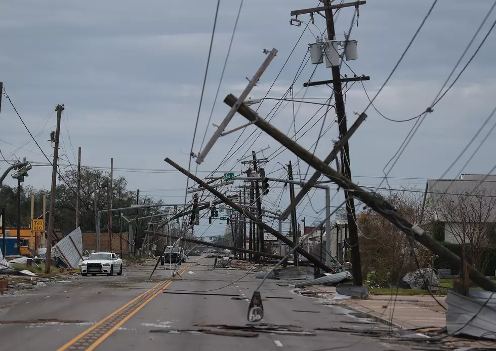
Hurricane Watches Posted Ahead of Zeta Along Louisiana Coast
The 0400 CDT advisory for Tropical Storm Zeta has been posted. The center of circulation of the storm is currently over land in Mexico's Yucatan Peninsula. After making landfall near Tulum Mexico late last night. The forecast track for the system suggests its current movement will carry the system back out over the waters of the Southern Gulf of Mexico later this morning.
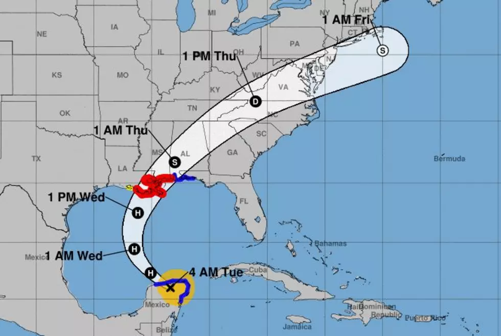
SUMMARY OF 400 AM CDT...0900 UTC...INFORMATION
----------------------------------------------
LOCATION...21.0N 88.4W
ABOUT 85 MI...140 KM ESE OF PROGRESO MEXICO
ABOUT 560 MI...905 KM S OF THE MOUTH OF THE MISSISSIPPI RIVER
MAXIMUM SUSTAINED WINDS...70 MPH...110 KM/H
PRESENT MOVEMENT...NW OR 305 DEGREES AT 14 MPH...22 KM/H
MINIMUM CENTRAL PRESSURE...984 MB...29.06 INCHES
Conditions over the southern Gulf of Mexico are unseasonably favorable for the tropical cyclone to intensify but that window of intensification should only last until the center of Zeta moves over the central and northern portion of the Gulf where wind shear and colder sea surface temperatures will likely cause the system to, if not weaken, at least not get any stronger.
As of 0600Z, the latest tropical model runs were in fairly good agreement on the path that Zeta might take as it approaches Louisiana's coastline. Most of the model guidance suggests the system will move to the northwest for much of today and then begin a northern trajectory later this evening. That path is expected to take a northeastward jog as the cyclone will be influenced by an approaching cold front.
It's this frontal system that is expected to steer Zeta away from a direct landfall in Acadiana. However, effects from the storm will likely begin to be felt over the area later today and this evening as Zeta picks up forward speed during its march toward the coast.
The official track from the National Hurricane Center as 0400CDT still targets extreme southeastern Louisiana. Currently, Hurricane warnings have been posted from Morgan City Louisiana to the Mississippi/Alabama line. Tropical storm watches extend westward from Morgan City in St. Mary Parish to Intracoastal City in Vermilion Parish.
Just to be clear there is a margin of error in this forecast and the forecast track could and will likely change before the system makes landfall. As of now, only the eastern sections of Acadiana lie in the cone of uncertainty of the forecast prediction. But you should remember like horseshoes and hand grenades close counts in hurricanes too.
Rainfall from the cyclone is not expected to be that heavy in Acadiana as the storm moves onshore late in the day on Wednesday. In fact, the bulk of the rainfall, two to six inches, is most likely over portions of Louisiana from Morgan City to the east.
Most of the rainfall received in central and western Acadiana could be attributed to the arrival of Zeta but it will also be influenced by an approaching cold front that should bring cooler temperatures to the area by late Wednesday evening and early Thursday morning. However, there is a pretty good chance of rain in southwestern Louisiana beginning later today.
The next intermediate advisory from the National Hurricane Center will come at 0700CDT.
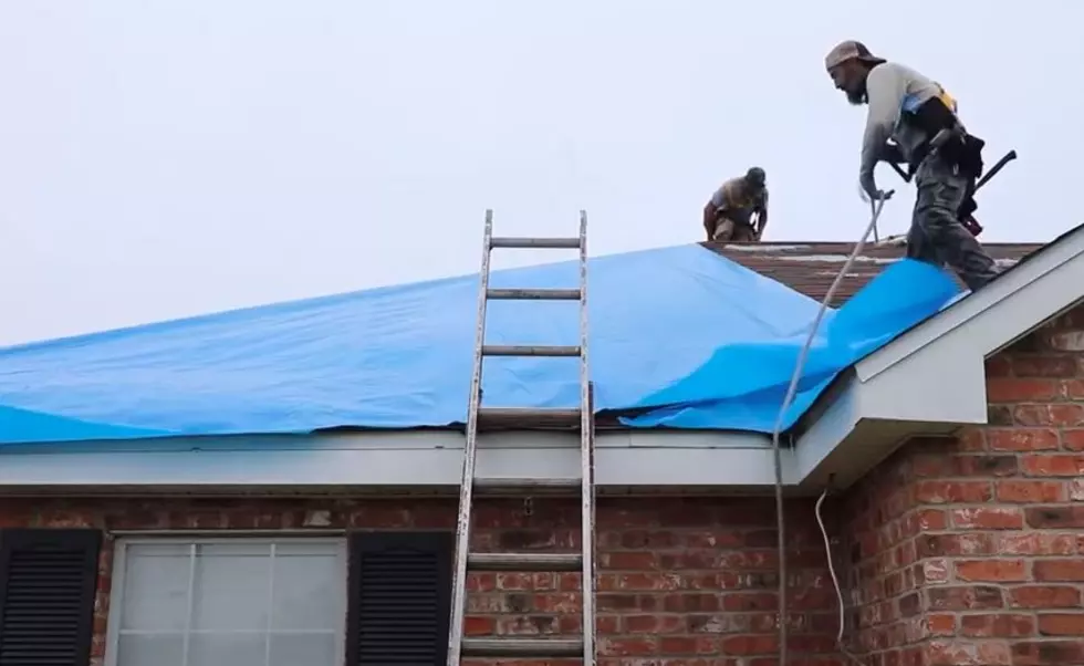
Things You Want or Need After Surviving A Hurricane
More From 92.9 The Lake