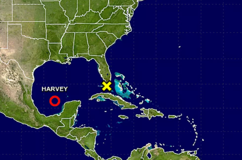
Storm ‘Harvey” Reforming in the Gulf — Get Ready for a Rainy Weekend
The National Weather Service (NWS) has just released new information on what was Tropical Storm Harvey and that news is that Harvey has now entered the Gulf of Mexico and is building up again.
Now, all the warnings and watches for the storm itself are posted from Port Mansfield near the Southern Texas Border to High Island, Texas. As of right now, here are the watches and warnings that have been posted by the National Weather Service:
A Storm Surge Watch is in effect for Port Mansfield to High Island
A Hurricane Watch is in effect for North of Port Mansfield to San Luis Pass
A Tropical Storm Watch is in effect for Boca De Catan Mexico to Port Mansfield Texas* North of San Luis Pass to High Island
Now all those watches and warnings are well to the east of us, but Harvey stands poised to bring yet even more rain and a lot of it in a short period of time.
According to NWS,
Harvey is expected to produce total rain accumulations of10 to 15 inches with isolated maximum amounts of 20 inches over the middle and upper Texas coast and southwest Louisiana through next Tuesday, with heavy rainfall beginning as early as Friday morning.Harvey is also expected to produce total rain accumulations of 3 to9 inches in portions of south, central, and northeast Texas and the rest of the lower Mississippi Valley. Rainfall from Harvey could cause life-threatening flooding.
Now, if we really get that much rain, we could be in quite a spot by the end of the weekend. We'll keep you posted on this situation, but in the meantime, you might want to stock the house with all the things you'll need for a few days.
We'll keep an eye on this storm and keep you posted right here and on the air at 92.9
More From 92.9 The Lake


![This Is What Interstate 10 Looks Like Outside Of Houston [VIDEO]](http://townsquare.media/site/34/files/2017/08/Screen-Shot-2017-08-30-at-10.53.30-AM.png?w=980&q=75)


