Arctic Blast Heading For SWLA With Lowest Temps Of Season
If you've been looking for colder weather here in SWLA, then grab your trendy hipster wool lined jackets and rejoice...cause it's coming!
Meteorologist Zack Fradella had to say this on his Facebook page:
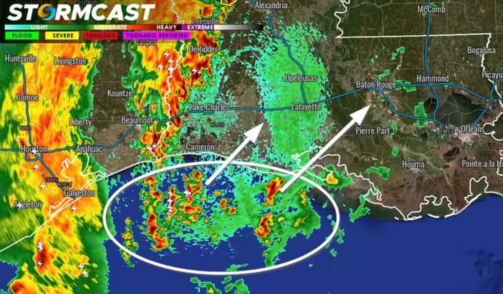
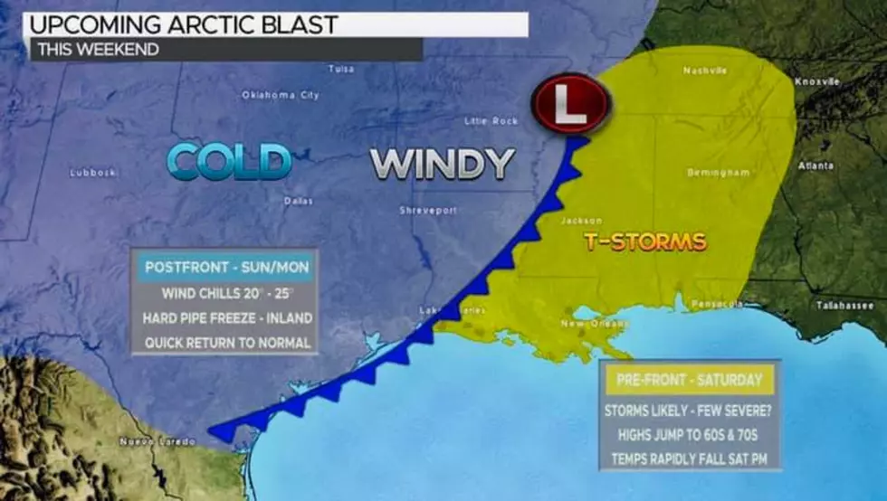
The first true Arctic air mass of winter will arrive in Louisiana on Saturday. Ahead of the front expect a quick warm surge that could lead to a few strong to severe storms. By Saturday afternoon/evening, temperatures will be rapidly falling as wind chills dip into the 20-25° range come Sunday morning. We could meet the criteria for a hard pipe freeze over inland locations Sunday night into Monday. Additional thoughts...this is a quick hitting Arctic blast, we return to “normal” come mid next week/the overall pattern will likely bring more chunks of Arctic air over the next 2-3 weeks/ I see no signs of frozen precipitation in the short term but this colder pattern favors mischief down the road.
For your up-to-the-minute SWLA forecast download our mobile app.
More From 92.9 The Lake